Beach access, kayak and paddleboard rentals and launch will remain open

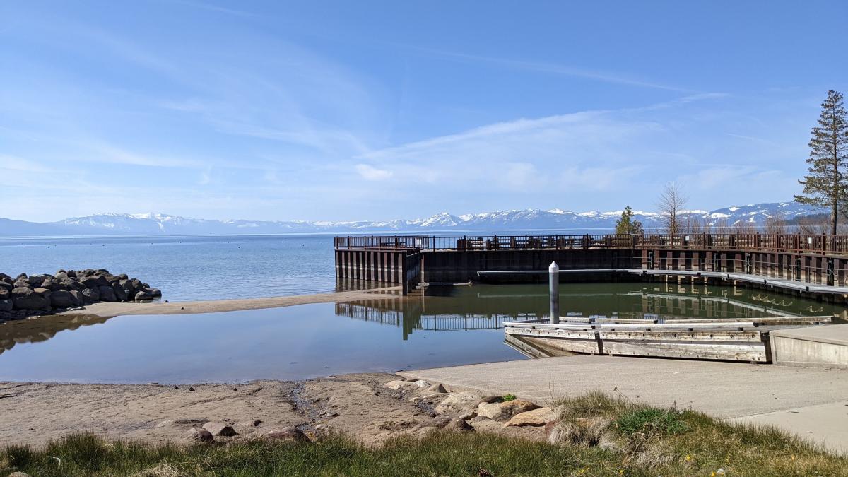
The Tahoe Vista Recreation Area boat ramp will remain closed for the 2022 summer season due to low water levels. A sandbar visible in a photo taken on Friday, April 29, 2022, at the entrance to the marina is preventing any motorized vessels from launching. Photo Credit: NTPUD
(Tahoe Vista, Calif.) Friday, April 29, 2022 – Due to continued low water levels, the Tahoe Vista Recreation Area (TVRA) boat ramp will remain closed to motorized boats for the 2022 boating season.
The North Tahoe Public Utility District (District), which owns and operates the ramp, will continue to offer launch access to non-motorized crafts such as kayaks and standup paddleboards that can be carried to the water and launched without a vehicle and trailer. Before launch, paddlers are encouraged to perform a self-assessment for aquatic invasive species.
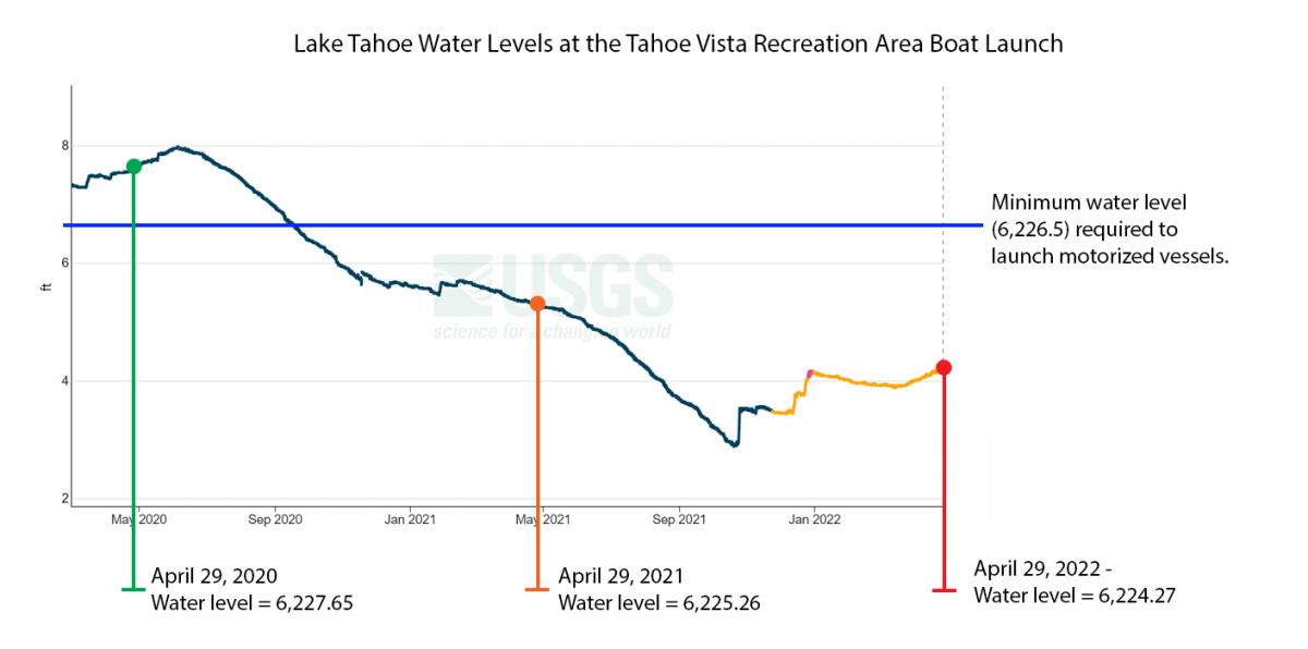
As of Friday, April 29, 2022, the Lake Tahoe water level at the TVRA boat launch measured 6,224.27 feet, one foot lower than measured at the same time last year. The minimum water level for motorized vessels to launch is 6,226.5 feet, more than two feet above the current water level.
All other lakeside amenities at the TVRA will remain open, including the beach and swimming area, picnic areas, public restrooms, and scenic overlook. The District’s seasonal kayak and standup paddleboard concessionaire will also operate as normal, beginning in May.
Those looking to launch motorized vessels are encouraged to seek alternative launch locations across the North Lake Tahoe region. To find another launch location, please visit www.tahoeboatinspections.com.

Lake Tahoe water levels at the Tahoe Vista Recreation Area boat ramp on Friday, April 29, 2022, measured 6,224.27 feet - one foot lower than measured on the same date last year, and over three feet lower than measured on the same date in 2020. The minimum water level for motorized vessels to launch is 6,226.5 feet, more than two feet above the current water level. Photo Credit: NTPUD graphic. Lake Tahoe gage height data/chart from USGS (U.S. Geological Survey) monitoring site 10337000 Lake Tahoe, Tahoe City, CA. (https://waterdata.usgs.gov/monitoring-location/10337000/)
